
![]()
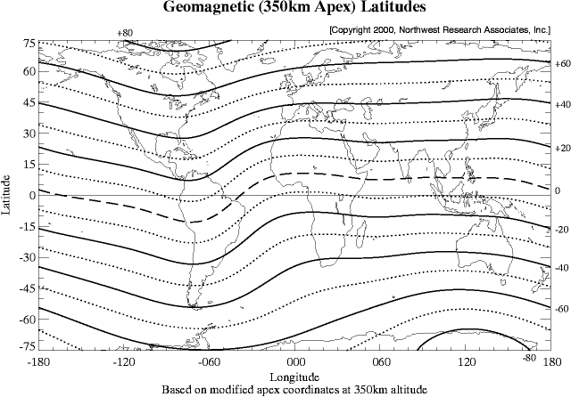
This maps shows lines of constant geomagnetic latitude based on apex geomagnetic coordinates referenced to an altitude of 350km. The geomagnetic equator is indicated by a dashed line. The coordinates were calculated using the IGRF-1985 geomagnetic field model updated to epoch 1990.0.
The coordinate system used here is a modified version of apex coordinates
as defined in the following reference:
|
![]()

Copyright © 1996-2024 NorthWest Research Associates, Inc. All rights reserved.